Update
#12 - January 2001
Virgin Islands
Distance run to date : 8,510 Nm
(9,793 Statute miles ; 15,760 Km)
By
late November our boat refitting was complete and Amoenitas was ready for
sea again. However, before our story leaves Trinidad, we'd like you to see
this picture of a huge space tracking radar that NASA operated on a
hilltop site overlooking the north coast. We cycled up there one very hot
and humid day and were amazed to find we had free access to the structure.
Dave was delighted to be able to climb up into the dish and beyond to the
top of the tower supporting the feed horn of what, judging by the
waveguide dimensions, was an 800MHz system. It was a great experience to
be able to examine the massively engineered mechanics and 1950/60s radar
technology, not to mention the stupendous view eastwards along the
northern coastline of the island.
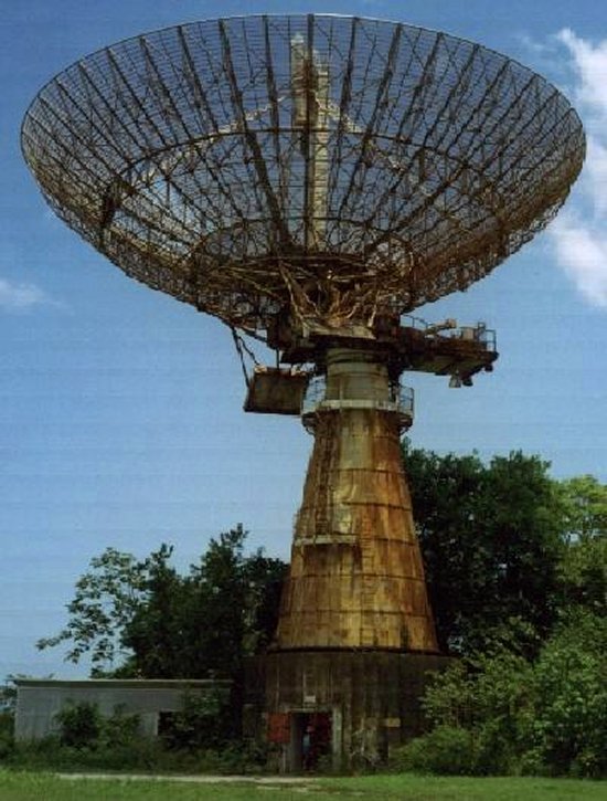
Abandoned
NASA satellite tracking station in Trinidad
Finally,
on the 4th Dec, a slot appeared in the strong trade winds and high seas
enabling us to make the 85Nm passage north to Grenada. Known as the spice
island, we found it's less humid climate a welcome change after our eleven
weeks in Trinidad. Again we were frustrated by strong weather conditions
delaying our progress north but we had many old sailing friends there to
pass the time with, as well as touring much of the island by car. Here's a
picture of Di on Fort George,overlooking the quaint and historic capital,
St Georges.
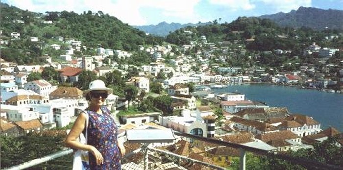
Picturesque
St Georges, the capital of Grenada
In
order to fulfil our plans this year, we needed to get up the island chain
quickly. So our next hop was of 190nm, by passing the Grenadines, St
Vincent and St Lucia to the French island of Martinique. We spent a very
memorable Christmas there, anchored off the small town of St Anne on the
SW coast. This picture shows a bathing stop at the popular Grand Saline
beach on our Christmas Eve hike along the superb south coast trail.
Christmas lunch was again a beach event, shared with around 50 sailing
friends from all around the world. We took over a restaurant's covered
area by the sea for a Pot Luck (US term for bring and share).
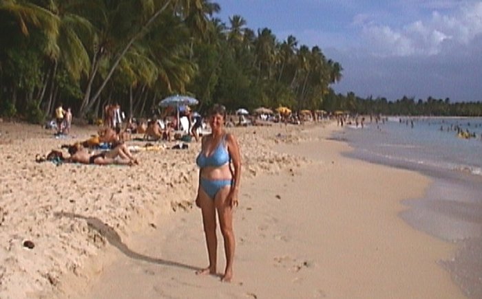
Christmas
Eve on the beach at Grand Saline Bay, Martinique
Boxing
Day saw us under sail again but lack of good winds this time confined us
to the west coast of Martinique Nevertheless, we made good use of the time
stocking up and enjoying the typically French cuisine.
We
really needed to get to the US Virgin Isles for New Year as we had planned
to share it with some US and UK HAM radio friends. Light winds or not, we
made the 320nm leg up to St Croix by the 30th to see in 2001 with sailing
friends aboard Amoenitas, watching a stupendous firework display.
New
Years day was another HAMfest. Dave logs into the Caribbean Amateur Radio
Maritime Mobile Net most mornings around 07.00 to give position reports on
passage, get vital weather data and share other information useful to we
cruisers. It has also been a great way to make lots of new friends, mainly
American as Dave and friend Clive from Revid are the only non US HAMs
amongst the around 150 regular contributors. Some of the linchpins of this
net live on St Croix so we couldn't pass by without saying hello.
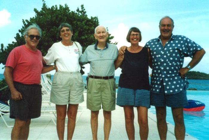
John
(MP2B), Jeanette (MP2C), Lou (KV4JC), Di and Dave (M0CJG)
Centre
of the group is Lou, our daily net controller and ever friendly voice over
the ether as we combat the elements. On the left is John, Lou's Sunday
relief controller with his wife Jeanette. The other two need no
introduction. It was great to meet up with the faces behind the voices.
Twenty
miles or so north of St Croix are the around forty, tightly packed islands
of the US and British Virgins. These are a sailing and cruise ship Mecca
which we live-aboardss view as somewhat of a mixed blessing. The cruise
ships mean ports packed with tourists and hundreds of jewelry, perfume and
gift shops with nowhere catering for the everyday needs of a cruising
sailor. We are also outnumbered around 20:1 by charter boats, mainly with
US crews. This makes for every anchorage being littered with mooring buoys
at $20 a night and astronomical prices ashore. Still the antics of the
charter fleet provide endless free entertainment.
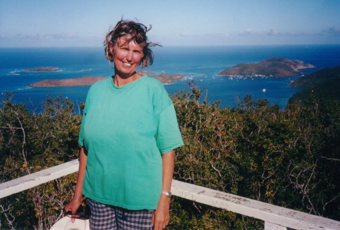
The
good news is the superb walking with magnificent seascapes. This view is
from St John, most of which is an unspoiled National Park with well kept
and signposted trails. The little Cay in the foreground was a favourite
snorkeling spot with many vividly coloured corals, sponges and fish.
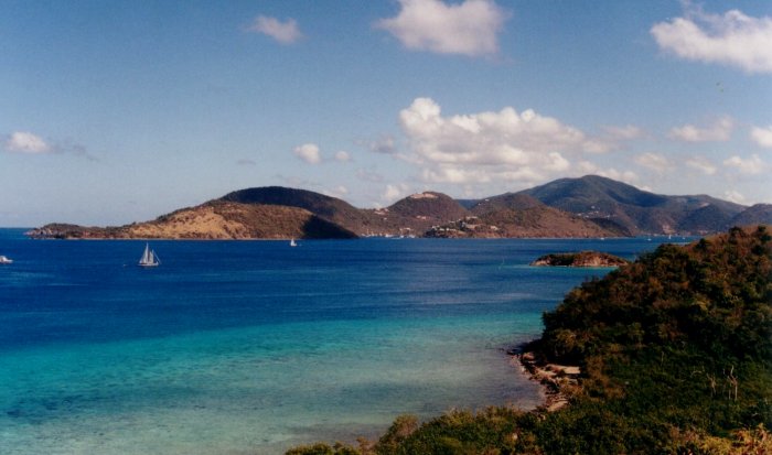
The
view east toward Watermelon Cay and Tortola from Leinster Bay, St John
This
next vista is the view eastwards from a high point we reached when
crossing over the island and back on the Johnny Horne trail to Coral Bay.
It was a very steep and rough walk on a very warm Sunday but views like
this are ample reward for any degree of discomfort.
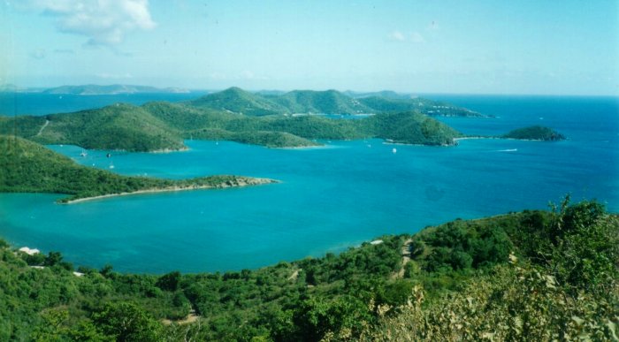
Hurricane
Hole and Round Bay, St John with Peter and Norman islands in the background
In
Coral Bay we spotted the vehicle below all dressed up with nowhere to go.
The Virgins are relatively arid islands compared with the Windwards or
Trinidad to the south. There this truck would have rusted to powder and
been lost in an even greater forest of vegetation.
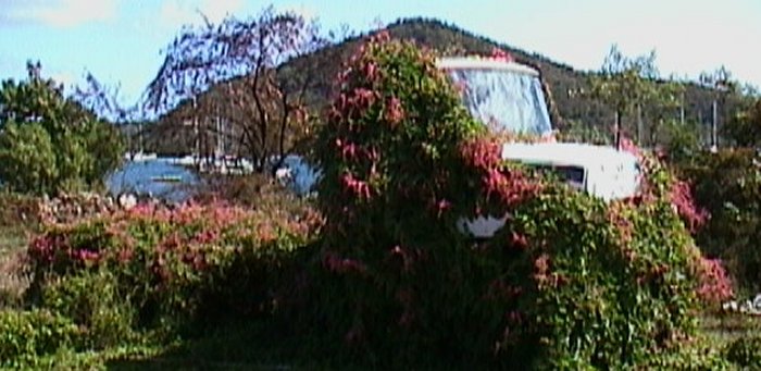
A
Ford truck, in Coral Bay unintentionally dressed overall for a parade
The
north of the BVI island of Virgin Gorda has a large sound which afforded
us good shelter when large swells came down from a major Atlantic gale
system. We visited several bays, some with romantic names like Drake's
Anchorage and again we found good walking in the Gorda Peak Park. The high
point there is at 1500ft, this view being toward the NE from the
observation tower, kindly provided to get above the vegitation.
The
north end of Virgin Gorda, the Sound to the left of the scene
Several
sq km of the southern end of Virgin Gorda are strewn with large granite
boulders up to 15m high. They were formed around 150M years ago when lava
was crystalised under high pressure, the softer surrounding rock
subsequently eroding away. The remaining rock field makes a scenic site
for holiday homes and good exploring on the shoreline where one can climb,
crawl and swim in the passages between and under them. Here's a picture of
Di beside some.
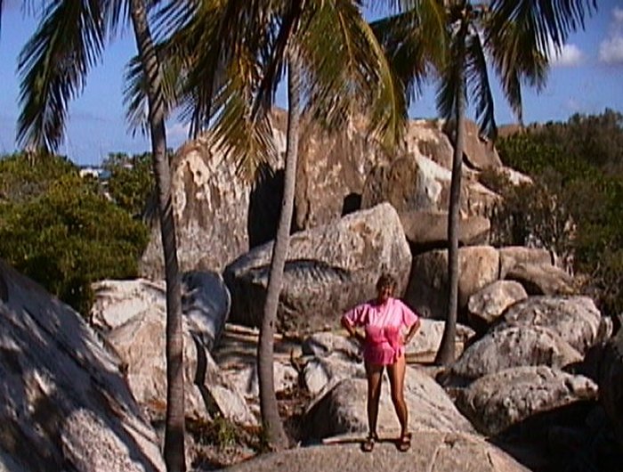
Some
of the remarkable granite boulder scenery at the Baths on Virgin Gorda
We
got to visit three of the major USVIs (St Croix, St Thomas & St John,
a similar number of BVIs (Jost Van Dyke, Tortola & Virgin Gorda) plus
a number of Cays and lesser islands. It was nice to have everything so
close but it is not really the sort of cruising ground we like best. Our
tastes are more for the quiet, unspoilt places of the planet. We did
manage to find some respite from the hordes by anchoring in a Newfound Bay
on the NE of St John which was protected by a fobidding, horseshoe coral
reef with a very narrow entrance. No charterers allowed there, just the
sea birds and four resident turtles who observed us nosily whilst keeping
at a safe distance.
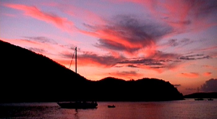
A
sunset at Leinster Bay, St John, US Virgins
As
usual we leave you with one of our tropical sunsets. This from the lovely
protected Leinster Bay in the National Park on the north of St John.
Where
to next:-
Our
next call will be at the Spanish Virgin island of Culebra, really part of
Puerto Rico, a US dependency. Then along the south coast of Puerto Rico to
the Dominican Republic. We are unsure yet whether to go along the south or
north side of Hispaniola but whichever, there are no plans to risk a stop
in Haiti! Then on to Cuba with Jamaica featuring somewhere in the plan.
Still we haven't decided where to hole up next summer, for the hurricane
season. It could be on the US Eastern Seaboard or back to Trinidad which
would give us a better start heading down to Panama for a Canal transit
into the Pacific early in 2002.
Return
to the Homepage
Return
to the Index