This section seeks to give an insight into some of the key systems we used to run Amoenitas and navigate safely on our 46,650nm (86,396Km) voyage of exploration around the globe. For a more complete specification of what gear we carried around with us, click on the button labeled 'Equipment' at the foot of the Homepage
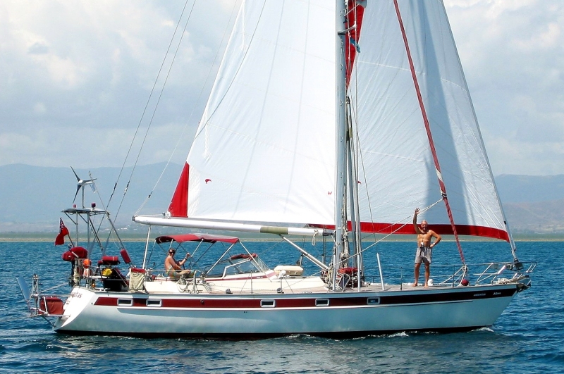
Amoenitas is a Najad 440, a strong, whilst swift, ocean going cruising yacht built in the classical Scandinavian style. Her major sailing performance strengths are derived from a large, high aspect ratio, sloop, cutter-rig, coupled with a deepish (2.3m draught) keel. Strength and safety is enhanced by the keel ballast of six tons of lead encapsulated into the hull and the rudder being supported on a full length skeg.
In this image you can see we relied heavily on renewable electrical energy from solar panels and a wind generator mounted on the aft goalposts. As we had both 12v and 24v battery banks the 4 solar panels could be configured in parallel (12v) or series pairs (24v). If the wind didn't blow or the sun didn't shine there was also the output of the two alternators on the engine or the diesel generator set driving two high tech chargers. Having adequate electrical energy is the key to happy cruising.
With an overall hull length of 13.3m (44ft) there is enough space and weight carrying capability to equip her fully with every system and safety aid we could possibly need to cruise the waters of the entire globe. As an example we had four self steering systems, two reliant on a hydraulic ram driving the rudder directly and two based on a wheel turning system driven by a wind vane or electronic tiller pilot (more on these later).
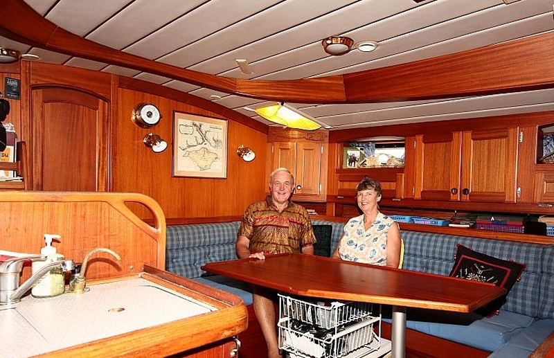
Once below you are into a significant rain forest depleting kingdom of high quality mahogany carpentry. The image of us in the saloon somewhat flatters the available space as Dave deployed his 10-20mm focal length lens. Note the print of the 18th century chart of our home waters we could console ourselves with in stressed conditions in the Southern Ocean.
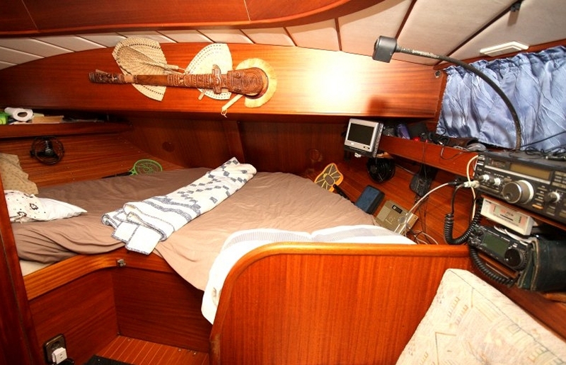
Our aft cabin, though comfortable and convenient was not a good 'sea berth' as in heavy seas one would have problems staying in one place. Our sea berth was the bunk in the saloon behind the table which with a lee cloth was ideal as one was close to the metacentre (roll and pitch centre of rotation) and could also keep an eye on the slave instrument displays in the Nav area. In southern ocean storms, the one of us off-watch would sometimes resort to jamming themselves into the corridor to the aft cabin beside the engine compartment with seat cushions.
No prizes for guessing who slept on which side. Looking aft are the HF SSB radios, satellite radio, broadcast receiver (LW, MW, Shortwave, VHF) and video display for DVD/MP4. The bats weren't to play games in bed but electrified bug killers.
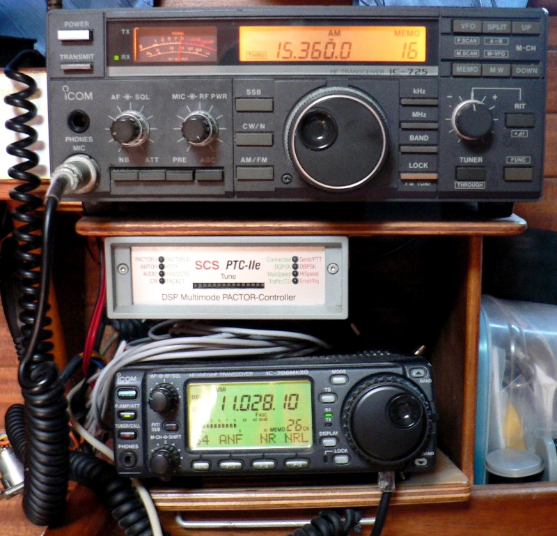
Around the coastline, especially in Europe, one could generally rely on marine VHF communication and latterly mobile phone. However, venturing offshore, particularly in remoter areas of the globe one has to have a High Frequency (HF, 1-30 MHz) transceiver. Fortunately, as a Grade A nerd, Dave holds a HAM radio licence which opens up access to a much greater part of the spectrum and the Winlink HAM data transfer network. This gave us e-mail traffic, using the Pactor modem, courtesy of local cooperating HAMs (HF typically has a range of 2,000 miles or so). Even so this could be tortuous as only one message path was possible on a single frequency which required great discipline from operators. This worked pretty well but for one nation's HAMs who were generally badly trained/licensed and considering themselves 'Exceptional' would use excessive transmit power to bump-off anyone on a channel. Then there was the data transfer rate limitations of HF's narrow bandwidth and noisy transmissions which meant transfer rates could drop as low as 200 bits/minute (yes minute, that's 3 million times slower than a 1Gb/s internet connection!). But at least we could communicate and get in weather Grib files anywhere on the planet.
The most challenging HAM link was with longtime colleague and close friend Chris, a formidable HAM who lives in our village. In 2004 Chris realised we were heading for Wallis island, a small, remote French protectorate between Samoa and Fiji. Some HAMs collect Q-Cards, records of conversations between them to commemorate significant contacts. Chris noticed from internet records that there had been no Q-Cards issued from Wallis in over something like 19 years so we set-up a schedule using e-mail (bit perverse really). After a couple of failed attempts we discovered that the propagation path over the north pole was open for about 30mins each day and Q-Cards were exchanged. Given the recent decline in HAM radio following the introduction of the internet, this might yet prove to be the last ever card from Wallis.
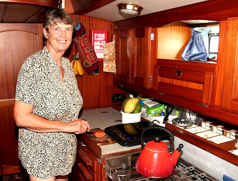
Di's preserve was the galley where she ruled supreme, providing excellent fare in the most trying conditions underway as well as conjuring dishes up in places where there was very little food to be had. Note that drinking glasses were preserved by storage in individual, foam lined compartment boxes behind the stove.
Dave's preserve was the Nav area from where all major systems were controlled. On the far left is the panel for boat systems, in the centre mainly radio, HiFi and boat instruments and on the RHS communications, radar, AIS and video entertainment. Note the collage of photographs of our grandchildren that we could gaze upon in rare dire conditions, to gain inspiration to survive.

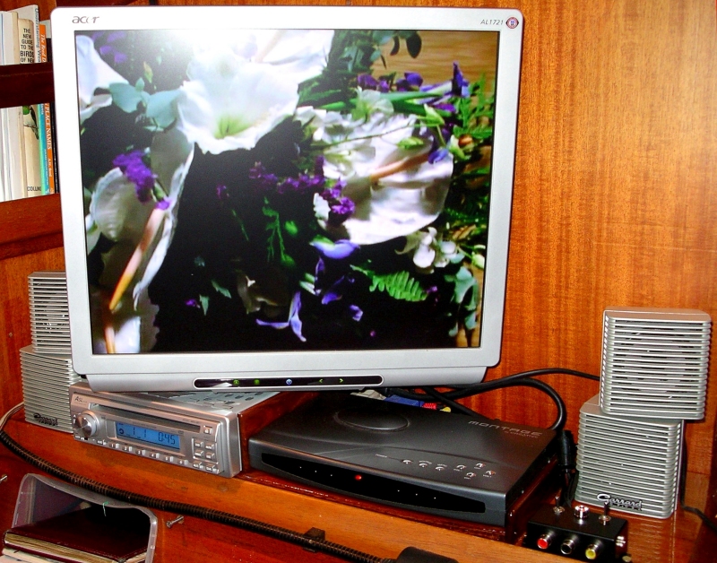
Our TV/video system was largely put together from components acquired on stopovers in Singapore on the way back to New Zealand and Australia between 2003-5, hence the odd shaped flat screen. It covered terrestial TV of any format, broadcast radio, MP3,VCD, DVD and MP4 through a media player.
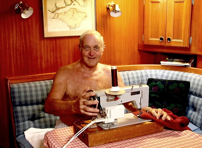
An essential capability in remote places is the ability to repair damaged sails. We were lucky enough to acquire a Reed's Sailmaker machine, assembled by a small family run business in Shirley, Southampton (now sadly defunct). Here Dave's making a canvas cover in Amoenitas's signature burgundy (the machine could handle 6 layers). Our most traumatic repair was to a mainsail whilst the only vessel on Beverage Reef, a submerged atoll in the middle of the South Pacific between the Society and Cook Islands. Strictly that is not quite true as there was also a wreck on the reef of the Seattle trawler, Nicky Lou, an incongruous sight all alone as we approached in nearly 3,000m of water.
Dave has always been the household's 'seamstress' due in the main to his childhood experience winding the handle of his mother's old Singer machine.
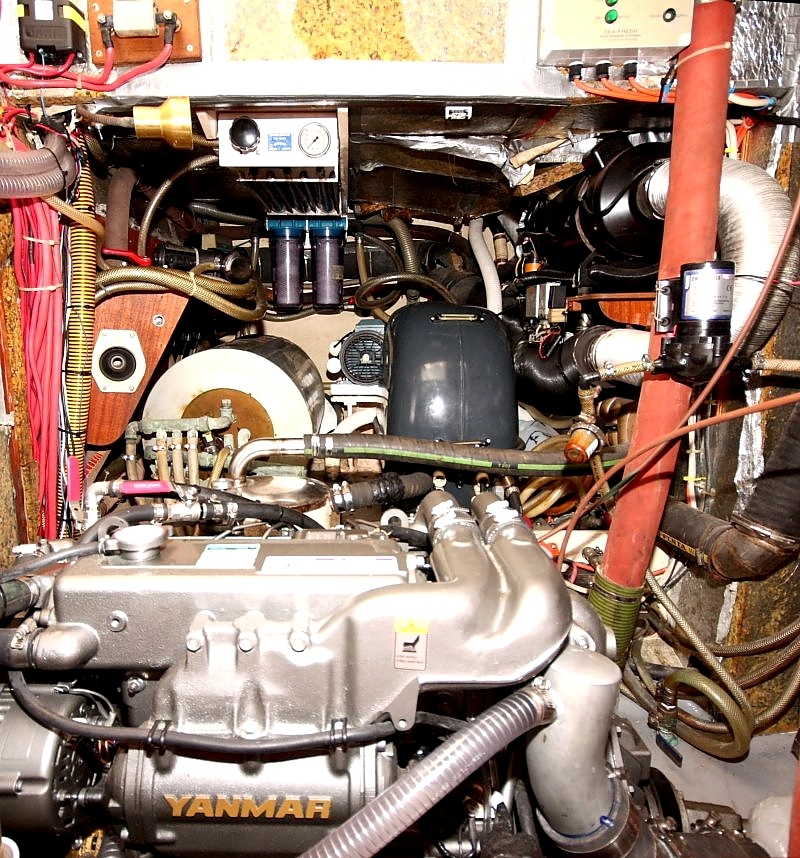
The contents of this somewhat over 'busy' engine compartment was another of Dave's domains in which he spent hundreds of hours whilst we owned Amoenitas. Access is not as bad as it appears as in addition to the ample side access there was front access under the main companionway and from above by a hinged cockpit floor.
In the foreground is the new Yanmar 4JH4G engine (110MHP @3200RPM) which we fitted in Rebak Marina on a small island off the coast of Malaysia in 2010. Behind to the left is the calorifier which heated water from the engine and also included an immersion heater. Under the dark grey cover in the centre is the 4.5KVA diesel generator set which gave us a 240v, 50Hz supply. In the main this was used to drive the desalinating watermaker, a pump that forced seawater at very high pressure through three semi-permeable membranes. This produced around 130 litres of extremely pure water an hour with an input feed temperature of above 28°C. On the RHS is a diesel fueled space heater which needles to say we never used once we had left the shore of Europe behind us.
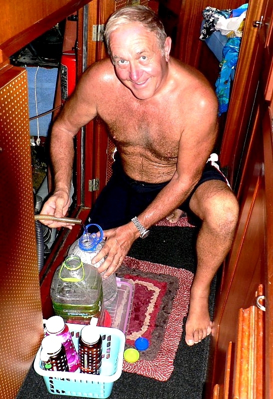
Here's Dave at the end of a watermaking session that normally took about an hour, filling bottles with water to drink and cook with after the main tank situated in the upper keel had been replenished. This system worked well and kept us healthy throughout the trip as well as supplying all the fresh water we needed for showers, etc.
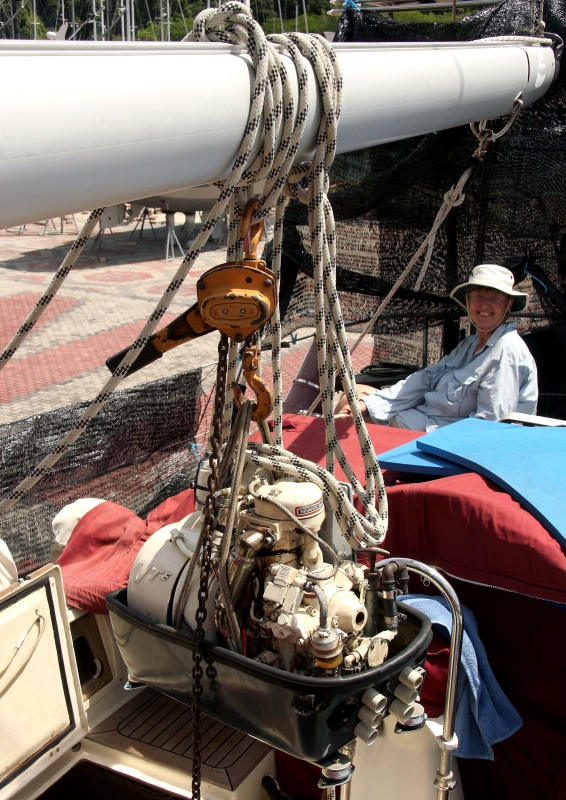
An example of how access to the engine compartment could be achieved is the removal of the generator set for a major overhaul and the replacement of eight flexible mounts. Below you can see it being hauled out through the cockpit locker using a pulley block mounted on the boom.
A means of automatic steering is essential on long passages as it reduces crew fatigue which in turn leads to safer cruising. Below is our Monitor system of wind steering which was used for about 95% of our passage making when under sail power. Having set the relative wind angle of the vane, it uses a pendulum blade in the water to power the vessel's steering wheel by two connecting ropes. It sounds and looks convoluted but it certainly works well and is silent as well as needing no electrical input, very convenient on long passages and at night when there is no solar power to be had. We also had two electronic, compass driven systems which activated a hydraulic ram connected directly to the rudder quadrant.
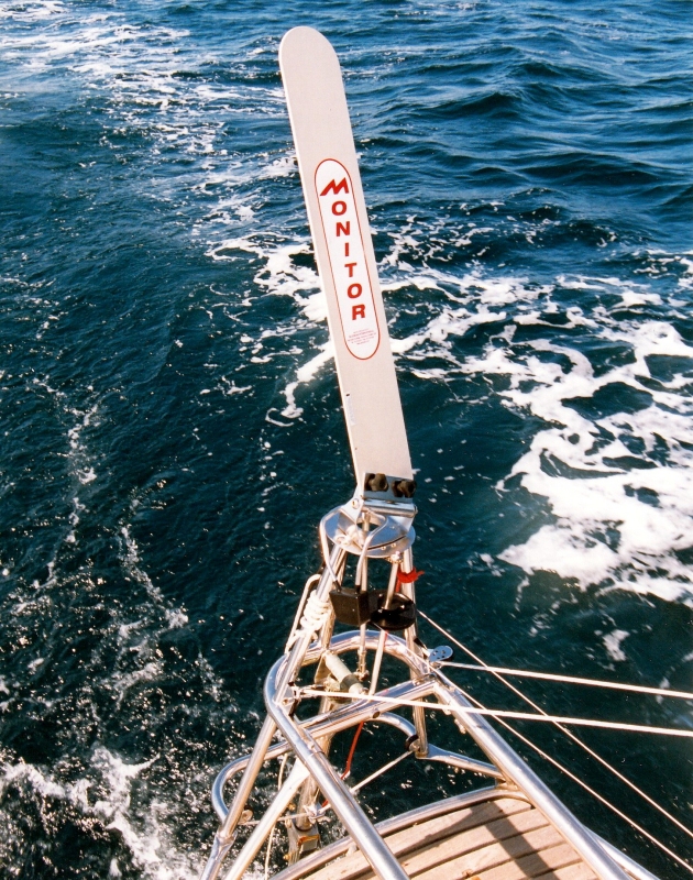
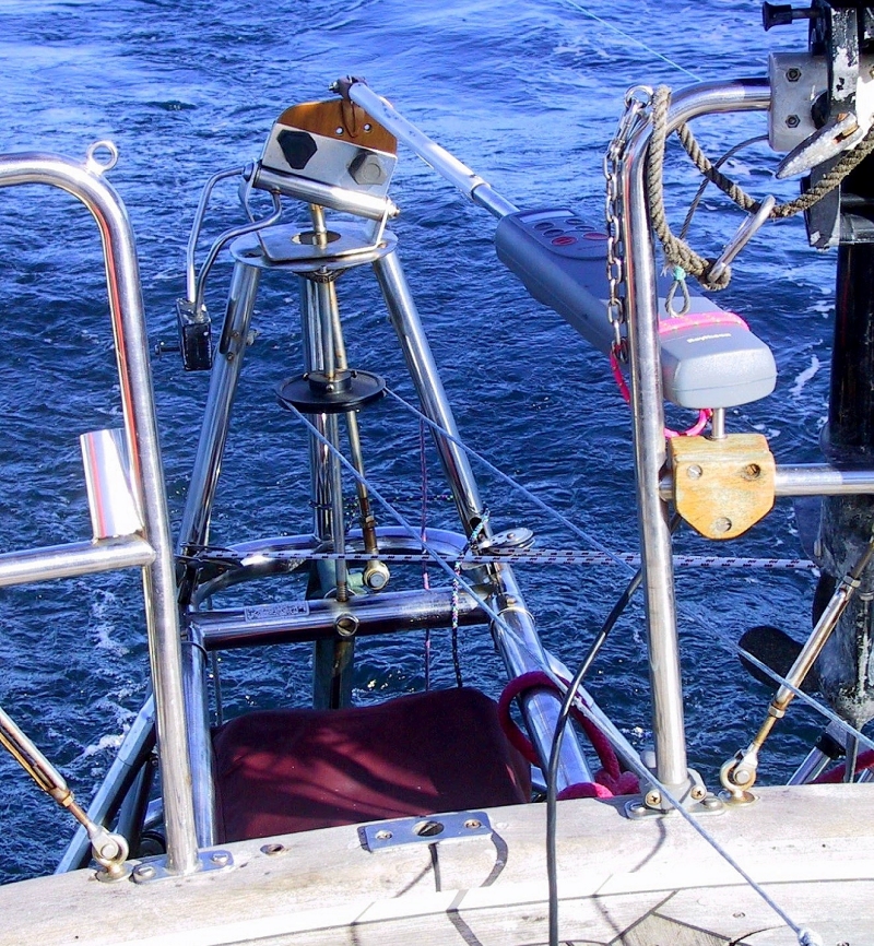
As if that wasn't redundancy enough, had the hydraulics failed we could replace the wind vane of the Monitor with a conventional tiller pilot to convert it into an autopilot. In the picture below the colour of the sea is typical of the deep wide oceans. Note also that we are trailing a fishing lure.
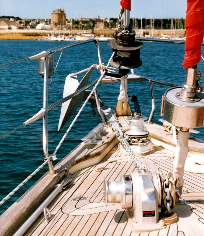
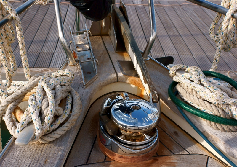
Another critical area is the anchoring system which needs to attach the vessel to a wide variety of sea beds in what can often be challenging conditions of strong winds. This picture taken in La Rochelle in southern Brittany in 1998, on the last 'shake-down' trip before we departed shows the foredeck layout. We were lying to our main bower anchor, a 34Kg Bruce on 50m of 10mm chain which took good care of us throughout the whole trip, never dragging once. Mounted on the port side is the auxiliary bower, a 27Kg CQR which normally is housed in the chain locker underneath the forward deck. This also held a further 50m of 10mm chain and two 50m, 16mm diameter ropes which could be employed to anchor in deeper water or enhance holding in strong winds. Our cooking gas bottles were also in there where direct venting over the side was possible. The main anchor, in use here, is hauled by the 24v 1.5KW Lofrans electric windlass. The auxiliary is connected to a hand operated windlass. Redundancy again as if you only have one way of 'skinning a cat' it will fail but with more than one, nothing ever goes wrong!
Well, that's not strictly true as our electric windlass motor failed in demanding 55kt storm conditions whilst we were in the Aeolian islands north of Sicily. We should have expected this as aeolian means windy! Replacing it proved to be a tedious job as the Italian makers had used the dissimilar metals of a stainless steel shaft through an aluminium alloy bush. Inevitably the seawater had seized it totally by corrosive reaction. We knew this would be a problem as we had difficulty removing this windlass in Phuket, Thailand in 2009 when we had fitted a new teak deck. When fitting a new windlass in Ragusa marina in southern Sicily in Feb'14 we knew that the only way was destructively with an angle grinder!
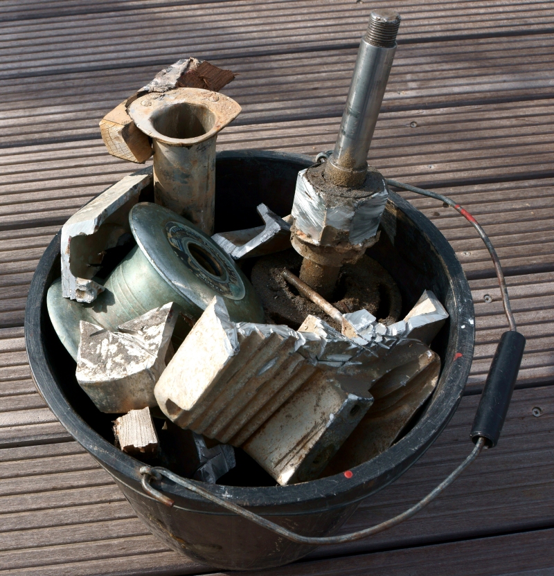
Here is the shiny, new replacement which sadly we only got to use for the final three months of our voyaging.
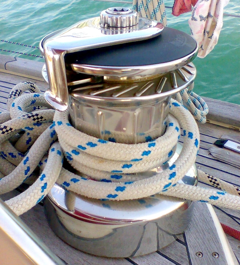
Other key bits of kit are the winches that haul the sheets. Ropes connected to sails are termed sheets, nothing to do with bunks. The example below was our largest which controled the Genoa sheet, the large foresail. We had eight of these superb, very expensive Andersen, stainless steel winches and were eternally grateful to the original owner who had specified them.
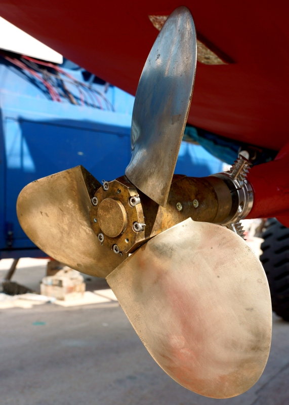
Not to be forgotten, the bit underwater that propelled the vessel under engine. Our propeller was a feathering Maxprop whose blades lined up with the flow of water when not in use, which significantly reduced the drag and possibly added half a knot to our speed under sail. We also had a rope cutter attached to the prop shaft, one those bits of kit that if it does its job well enough, you are never aware it is there.
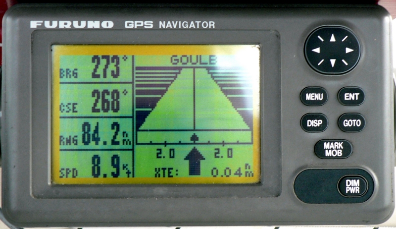
Sailing around the world was made so much easier when GPS positioning systems were introduced in the early 80's and contributed more than anything else to the vastly increased number of people joining the long range cruising fraternity. Here our trusty instrument is displaying course and speed as well as range to the waypoint named Goule showing also our approach on a roadway type display. Two other points, we are doing an exceptionally good speed of 8.9kts and are only 0.4nm off the direct path we had chosen, pretty impressive really as the theoretical maximum hull speed of Amoenitas is only around 8.0kts. We can't remember the occasion but either we were in strong wind conditions or an appreciable favourable current was assisting us.
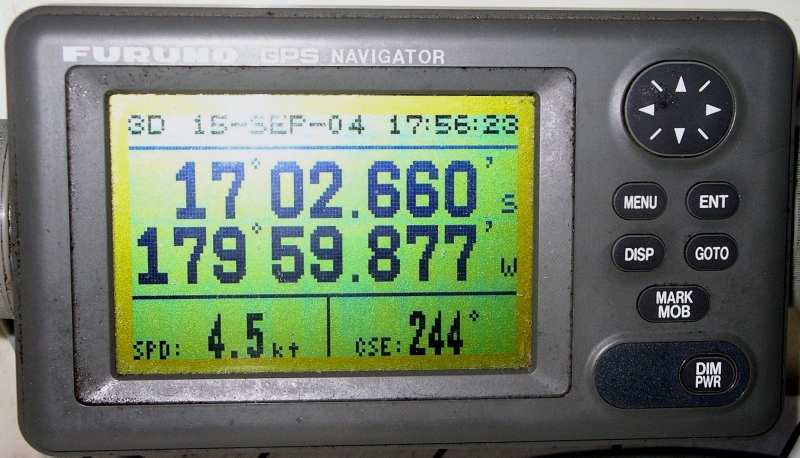
Another useful display format is this one that shows position speed and course. You can also discern that it was 5.56pm on 15th September 2004 where, though we are only making 4.5kts, we are in an interesting place. At a latitude of 17° south we are transiting a very narrow and badly charted channel on the south side of Fiji's second largest island and had just within the last second crossed from the east to the west hemisphere of the globe.
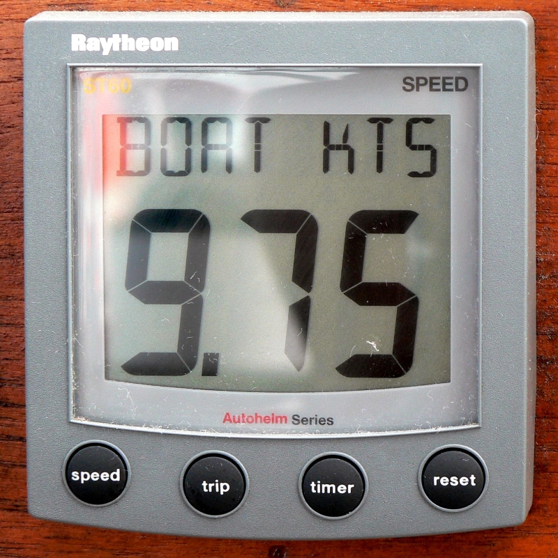
Another useful parameter is the boat's speed through the water which is derived from a rotating impeller mounted in a place of stable water flow under the hull. Comparing this speed with that displayed on the GPS, it is possible to quantify the effect of currents. At 9.5kts you can see why this event was recorded.
Another technical advance that made seafaring safer appeared around 2002 when AIS (Automatic Identification System) was introduced. This mandated that any vessel over 200ft in length had to be fitted with an AIS transponder that broadcast information about it's position, speed, course and critically its name. The latter is important to those in small vessels who can fairly cheaply receive and display the information about any vessels in their vicinity but do not carry a transmitting device to report their position. Previously, if you were under threat on the high seas from a vessel bearing down on you, all you could do was call out your position on channel 16 of your VHF transceiver or maybe at night shine a bright source of light toward the oncoming craft. The basic weakness is that the standard of watch keeping on many commercial vessels in remote areas is not of the best and the guy on watch will probably not be able to relate to a numerical lat/long position. However, if you call his vessel's name and give him advice on what course of action may need to be taken, he'll immediately be on the ball. Not only may other vessels overhear the call but thanks to the intelligence agencies, every transmission on earth is monitored and recorded. No hiding place then if they mow down another vessel.
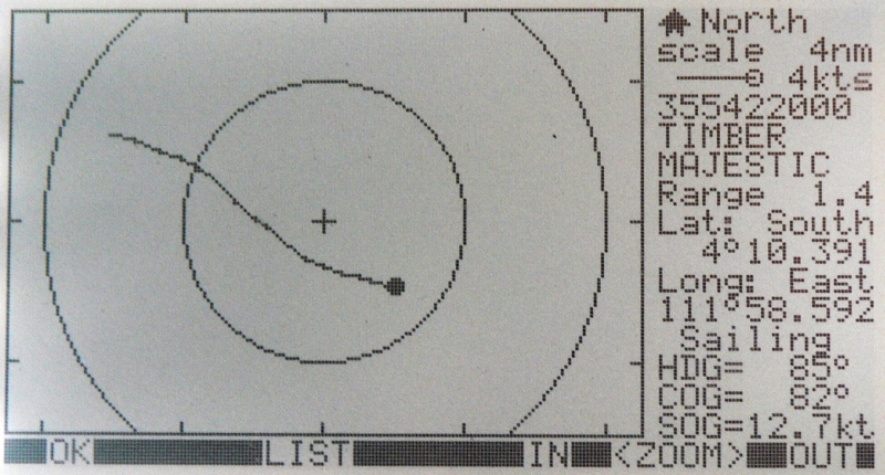
As an example, below is the plot of the freighter Timber Majestic heading straight for us at 12.7kts in the South China Sea. We could see when it was still around 4nm away from us that a collision was a distinct possibility. By 2nm out we had been able to call him and get them to alter course sharply to starboard.
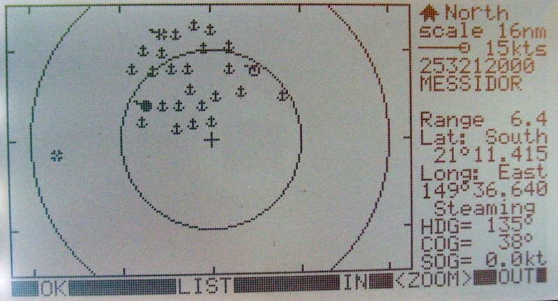
A further example was on our approach to the port of Mackay in northern Queensland, Australia when just a few miles out from the harbour, just before dawn, we were confronted with a flotilla immediately ahead of us. (our position is the screen centre). We then threaded our way through a plethora of iron ore bulk carriers awaiting a cargo. Many had been hanging around for several days or even weeks because the Oz railway system could not handle the quantities of cargo involved. The vessel's crew and owners, mainly Chinese were more than happy as they were collecting substantial waiting time compensation from the shippers.
This below may look look like a skeletal Christmas tree when actually it is the antenna of the system Dave built to download weather images from passing weather satellites, in festive mood. Technically it was quite demanding to make on a boat without suitable test equipment. It is called a Bifilar Helix and has the property of receiving circularly polarised signals at around 150MHz over a hemispherical area from grazing angles to the sea up to the zenith directly above.

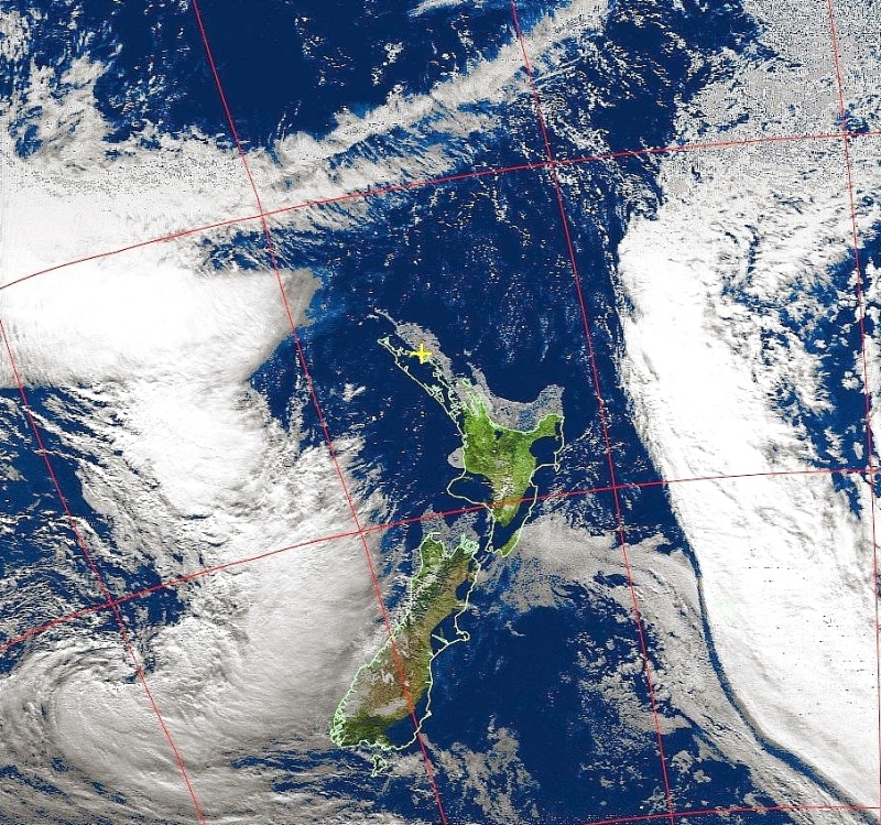
Here is an interesting image downloaded in New Zealand at the point in North Island where the yellow cross is. The overlaid map does not precisely overlay the land image due to a minute timing error (2-3 seconds) latency in the satellite ephemeris data which tells the system where in space the satellite is located. The really interesting feature is the huge wall of cloud approaching from the east. NZ is around 1,500 miles long so the cloud edge is clearly defined for probably over 2,000 miles. The image was taken at 10.20 on 20th June'05 when the NOAA weather satellite #17 was approaching from the east at an elevation of 86°, the pass takes around six minutes. With the low morning sun off to the RHS it is possible to discern the shadow of the sheer edge of the cloud. Amazing stuff!
This was all of more than academic interest as the remote oceans are not covered by enough data points to create reasonable forecasts and this technique often gave us warning or explanations for local conditions.